Sunday, December 20, 2009

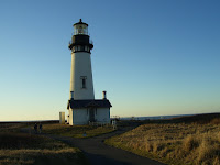
Heceta Head Lighthouse


One of the most beautiful spots on the Oregon Coast is Heceta Head Lighthouse. Just after you drive south past Sea Lion Cave on Highway 101 you come to a turn-out on the west side of the road. You must stop! Get out of the car and walk up to the edge. Across the bay to the south is the Lighthouse sitting out on the edge of the head. To the right, sitting behind a white picket fence is the keeper's house. The head keeper's house was torn down after the light was automated. But luckily, the assistant's house sit remains. It was constructed as a duplex serving the families of the two assistant keepers. The common wall that separated the dining room has been torn down to allow the building to become a bed and breakfast with a most spectacular setting.

Once a year, for the two week ends prior to Christmas, the keeper's residence is decorated and lights are hung and the entire site is open to the public from 4-7 on Saturday and Sunday evenings. In addition to the period style decorations, there is live music provided by local musicians, hot drinks (coffee, tea, hot chocolate) and cookies and bars to enjoy. After enjoying the ambiance of the house, R & I walked to the gift shop to check find many treasures. Then it was stroll up to the tower itself. I had remembered to bring a flashlight so several visitors walked with us in the dark up to the lighthouse. A volunteer greeted us in the work room and told us the story of the light and before taking us up the stairs to see the light itself.

The 56 foot tower was constructed in 1894. The light pattern is a flash every 10 seconds. Because the light is 205 feet above the ocean, the light can be seen 21 miles out to sea, rated as the strongest light on the Oregon Coast.

Friday, December 11, 2009

South Beach State Park


Well we are now at South Beach State Park near Newport, Or. It is a beautiful example of the Oregon State Park system. There are over 250 campsites and yurt sites scattered in several loops. All sites have paved driveways and water and electricity. During the summer over 2000 people a day are in this park, either in the campground, picnic ground, or at the beach. But today there are just a handful. Normally, the weather at the coast is moderated by the proxima... (closeness) of the ocean. It doesn't get really hot and it doesn't get really cold. Well, except for last week. A large cold front stopped by and dropped the temperature into the high 30's in the day and the 20's at night. The park here is not set up for cold weather so several faucets have been replaced this week due to the freezing temperatures.


The weather is beginning to moderate with rain in the forecast. The Willamette Valley is experiencing freezing rain as I write this, because the rain has returned and the ground is still cold.


Yesterday was our day off so went into Newport to look around. We ended up at Yaquina Head Lighthouse which is just north of town. It started construction in 1870 and was completed in 1872. It took so long because the 300,000 plus bricks were brought by ship from San Francisco. Not having a harbor meant that cargo needed to be unloaded unto small boats for the trip to the beach. Also when the lens arrived (via supply ship), it was discovered that parts of the Fresnel lens were missing. So the missing parts had to endure the same long journey that the lens did the first time, which was Paris to New York by ship; New York to Panama by ship; across the Ismus by Train ( that was before the Panama Canal); Panama to San Francisco by ship; and then by lighthouse tender from San Francisco to Yaquina Head.
After spending an hour or so exploring the visitor center, we drove the 1/2 mile out to the point where the lighthouse is perched on the edge of the cliff. We climbed the 110 stairs to the top and had a great visit with Tom, the volunteer who was stationed in the watch room. He had many stories to tell of the lighthouse and the people who manned it. R and I will go back again on another day to check out the tidepools located below it.


Monday, November 2, 2009

To Sleep Perchance to Dream

She knows he wants her so she comes to his place. She arrives in a large red balloon. The balloon distracts the others who have gathered around his place so that she can slip into his place.

When she enters, he initially runs away from her, but then turns to greet her. As they get close, they hear sounds of others approaching. She runs. As she runs around inside the house looking for a way out, she passes a stranger running the opposite direction calling her name.

Finding the door, she runs out. She finds an old Columbia-style bicycle and rides it past the window. As she passes the window she glances in and knowing that they will never be together.

Monday, October 12, 2009

M C


"M C "are letters that you will see on small yellow signs with an arrow on them that are posted around the Burns area. A movie is being filmed in this area and it is an exciting deversion for a small town. Star sitings are being discussed at coffee shops and grocery stores. It does give the locals something to talk about besides the weather and hunting. Featured in the film are Bruce Greenwood, Michelle Williams, and Will Patton. My wife and I had lunch and the local deli and Bruce Greenwood and another cast member sat at the table next to us. If you have seen the new Star Trek movie, he was Captain Pike. His voice gave him away even before I saw him.

The MC signs are posted at road junctions to give directions to the filming locations for the cast and crew. The name of the movie right now is "Meeks Cutoff". It is the story of an 1845 wagon train of 200 wagons led by Stephen Meeks, who tried to find a short cut that deviated from the well used Oregon Trail, traveling through central Oregon, over the Cascades and into the Williamette Valley. The route turned out to be a long and dry route that did not live up to Meeks promises. The result was many days of being lost with little food or water and many fatalities tallied along the way. http://www.historicoregoncity.org/HOC/index.php?option=com_content&view=article&id=123&Itemid=75option=com_content&view=article&id=123&Itemid=75option=com_content&view=article&id=123&Itemid=75

Several scenes for the movie were filmed on the refuge and many more in the surrounding areas. The film crew has been exposed to warm days and cool nights early in the filming and now that fall is here, cool days and cold nights are the order of the day. The flora, fuana, and dust have not changed much since 1845 as it is still a harsh and unforgiving place.


My wife and I received the opportunity to visit the site of the filming for an night-time shoot. We followed the "MC" signs to the remote location which required 5 miles of gravel washboard road. It was just getting dark but the "day" was just starting for the movie people. Workers with tools and equipment were scrambling here and there The catering truck had breakfast items ( eggs, potatoes, cereals, fruit available for them as well as torillas and the walk-up window for special requests such as ham and cheese sandwiches.


We had the opportunity to meet the location manager and received an incite into the happenings going on around us. We were welcome to be there and observe the filming, but to be aware enoiugh to stay out of the way and to remain quiet during the actual filming. As for the filming, it was nearly completed. All that remained was several nights of shooting get done.


The oxen had been shipped back to where ever they came from and the only animals remaining were a donkey and a mule. There was still and representative from the ASPCA on site to keep watch. There is a rep there whenever animals are present so that the certification, " no animal has been harmed in the filming.........." can be displayed during the movie credits.


So after and hour of conversation, we walked over to the filming site. It was the last night for Bruce Greenwood as he has another film commitment beginning in a few days. The scene we observed was Stphen Meeks ( Bruce Greenwood) lying on the ground, musing about the meaning of life or something like that. There was no dialogue, no motion. It had all the excitement and drama of watching paint dry. But they all can't be fight scenes, I guess. It was fun and interesting just being there. A little bit of Hollywood in Harney County.

Monday, October 5, 2009

John Day Fossil Beds


Drive west of John Day on Highway 26 about 30 miles through Mount Vernon and Dayville and north 2 miles on Highway 19 puts you at the Visitors Center for the John Day Fossil Beds National Monument. There are three units of the monument separated by many miles that the VC represents. Each unit is unique in it's topography, geology, and fossil remains, but the total is amazing. An hour spent at the center is almost overwhelming with the all the displays showing the varied flora and fuana that lived in the area over the eons. I recommend a visit to the area and to the visitor center.


Just 1/4 mile down the road, is the James Cant Ranch which has a large beautiful home built in 1917 by James Cant who was a Scottish sheep rancher. The home has about ten bedrooms because it was a gathering place for travelers in the early 1900s. It was also a social site as the Cants hosted "skip to my Lou" parties in the big white house, which was recently converted into a museum packed with various artifacts: Mother Cant’s recipe for macaroon cake, a beaver trap, a sack of oily sheep’s wool and other historic artifacts and pictures are displayed in part of the house.


An old haystacker hulks in the orchard of heirloom fruit trees, near the wonderful barn that was designed specifically for sheep with many shearing and lambing stalls scattered about. In the hills and flatlands where catlike nimravids and terminator pigs once stalked their prey, you can wander the Cant Ranch and explore the rest of the John Day Basin in search of a glimpse of the past and a restful escape with picnic tables available.

Thursday, September 24, 2009

Steens Mountain Revisited


Steens Mountain Revisited

It’s always nice when friends stop by. When you are out here in the boon docks, it’s even nicer. Old friends B & B, who we have known since my time at General Cable in Lindsay, Ca. in early 70’s, spent a few days parked next to us here at the refuge. The refuge is very gracious about allowing friends to pay visits and enjoy the hospitality of the facility. We had several meals cooked in our rigs but eaten together in the guest house and hours of great conversation.

So yesterday it was time to take them to the mountain. We started by 9:00 am, drove through Frenchglen, and started up the south end of the 60 mile Steens Mountain Loop. The weather cooperated giving us lots of sunshine and little wind. Light jackets in the morning, t shirts in the afternoon. The south route is quite a bit more challenging due to the steepness, ruts, and rocks, but it is a blast to negotiate. The condition of the road is actually a bit better that last year because many of the holes have been filled in with gravel. Even then the top speed in the section called the Cock’s Comb is a blistering 10-15 mph. The elevation gain, is about 2000 feet in about three miles and the scenery is amazing so everyone in the car is busy looking around.

We made the summit about 2:00pm and spent a couple of hours above 9700 feet with binoculars and cameras being well used. This spot is the highest place in Oregon that you can drive to. Then it was time to continue on around the loop and descent using the north route which is a wide relatively smooth, gravel road. We saw wild horses, deer, but no bighorns. Heading back home on Highway 205 south of Frenchglen we saw a sight that caused us to turn around and go back to see if we had imagined it. But there they were, about a dozen pheasants were perched in a juniper tree, checking things out. ( You can click on this picture or any of them and zoom in for a better look.) It surely was an interesting sight.
We arrived home about 6:30pm tired, dusty, and happy.

Wednesday, September 23, 2009

Bike Herding

Here we were riding our bikes as we do several times a week our here in eastern Oregon. We had been using the paved road (Sod House Lane) because it’s flat and has little road traffic. Two weeks ago we changed our starting location because one of the ranches had sheep grazing in their pasture and, as we rode by, a grey dog that looked a lot like a sheep, came through the wire fence and out on the road to bark at us and let us know that he did not want us near his sheep. We rode past quickly and went down the road. Looking back I watched the dog standing on the side of the road waiting to see if we returned. So when we did turn around and ride back to the truck he was there. As a precaution I had picked up a stick which I intended to use to discourage him should he decide to attack us. Well, he didn’t do more than growl and posture which I was thankful for. But as a precaution, the decision was made to start our future rides further down Sod House Lane, past the sheep pastures.

And so we come to last evening. R and I have parked the truck at our new starting spot and are heading west. Who should we encounter but two cows and their calves walking along Sod House Lane. These bovines are not as tame as the ones at the ranch so when they see us they start trotting away from us. So here are four cows trotting and two bike riders peddling west on Sodhouse Lane in the late afternoon. It was a interesting site and we got a kick out of our herding abilities. After about a mile, one pair veered off to the left, through a gate and into a pasture. The other pair went a short distance further, veered to the right, jumped a fence and kept on going. R and I kept pedaling until we got to our turn-around spot and reversed our direction. Cows aren’t the most intelligent four legged creatures on the planet.

Sunday, September 13, 2009

Winnie


For those who wondered about the title of this blog, let me tell you about the name. Winnie is the name of the sweetest dog you could ever meet. A retired racer, greyhound by breed, sweetheart by nature. The first six months we had her she only barked six times. Then our dachsunds, Molly and Peaches, taught her that when the garage door goes up, the people are home and we will get food, petting, a walk, or all of the above so it's time to tell them to hurry up and get in here.

As I was saying, Winnie, came to us through adoption, via Homes4hounds.com . They are your source if you are looking to adopt a dog that you will love for ever, a greyhound that has been rescued from the track.
Winnie was a "rehome" which means that she had been adopted by another family and, for some reason they could no longer take care of her. So, by contract, if you can't keep the dog, you can give it back to H4H to be adopted out again. We were lucky enough to get her in this way. We picked her up on a Sunday evening, took her home, and because we had to work on Monday, left her home in the laundry room with our two doxies all day. Much to our relief and joy, there were no problems when we got home. The little dogs kept her company, taught her "the ropes", and helped her feel at home. She melded into our family as if she had been part of it for years.

That was four years ago and Winnie was a big part of our family, size-wise and love-wise. Everywhere we went , people would come up to us and want to touch her and pet her and it was a problem. In fact, she was a bit reticent and had to be coaxed not to hide behind me at times. As time went along she was more at ease with people and actually would slowly edge over toward them so that they could pet her. People couldn't get over her coloring and the softness of her fur.

The walk was a big part of the day for all of the dogs. She was always at my side. They say never let a greyhound off leash. Good advice at least intially. After a while when we went to the beach and it was safe, I would let her off. She would take off at full gallop and run huge figure eights in the sand with me as the crossing spot. I could almost see a smile on her face the whole time. After about 15 minutes of this joyful experience, she would slow down and come over to me to be loved. I would pet her and praise her and then we would walk together down the beach with her at my hip, unleashed, breathing heavily and happy as a clam. I tried this procedure in grassy fields with the same results and the same joy. It makes me smile to think about her running. In our backyard upon letting her out, she would streak around the yard flying past the window going one way and then the other until she was fulfilled.

But sadly, no more. We had to let her go to a better place yesterday. For the past couple of weeks she had been less active, not running when off leash and then walking more slowly. The vet said it probably was an infection and gave her meds. They didn't help and she ate less and less. Yesterday, Sat, the vet brought her in and using xray and by actual feeling it, located a mass.

CANCER

Good Bye, Sweet Girl. We will miss you !

Thursday, September 10, 2009

Carp Fishing


I know, your heart quickens as the very mention of the phrase, "carp fishing", but there is more than just the glamour involved. When you are working at a wildlife refuge, your attitude is different. You look at things from a more boilogical view. When we volunteered to go out with some of the crew here at the refuge when they stated that they were going carp fishing, I was not sure what was in store for us. Carp have infested Malheur Lake and a long portions of the Blitzen River. They muddy up the water which is bad for the birds and the natice fish so they are a problem.


Seven of us headed out in government vehicles to the Double O area of the refuge. After driving for about an hour on a road that went from gravel to dirt to just a track, we arrived at a spring-fed pond. The pond is land-locked but the carp arrived during the high water of the 1980's when the whole valley was flooded for several years.


Our visit to the pond had two purposes. The first was to catch as many fish as we could and thus get them out of the pond. The second, and more important was to test the captured fish to see if they were infested with any bacteria or diseases that could be harmful to the ecology of the fisheries of the Blitzen Valley.


So out came the fishing equipment; rods and reels, nets, buckets to put the captured fish in until they were tested, bait. Now we are not talking about fancy lures or flies, or anything like that. Worms, and canned corn. but the bottom line is that the fish were not interested in either. We moved around the pond, tried different combinations, such as just worms, worms and corn, just corn, even those combos with "trout stink" on them; with pitiful results. Eight people, five hours, six fish. I have included a picture of three of the carp who volunteered in the name of science. Notice the roe in fish number one and the swim bladder has been pulled out of fish number two. I, at least, did my part and got one, but they were just not interested in our food. There were plenty of fish swimming around. They were just not interested.
It was, however, a very nice day at the pond.

Tuesday, August 18, 2009

The Irish Music Festival ( or Celebration) is held annually at Harriet Island on the Mississippi just across from downtown St. Paul, a very scenic spot. We were lucky enough to be in the area during it’s three day run. We arrived at the site about 10am and so the crowd was just starting to increase. It was a no-charge event so lots of families were showing up. Security was checking incoming bags as no coolers were allowed on site. No outside beer, pop, and unfortunately, even bottled water was allowed. I asked the security person about the ban on water, especially when it was going to be a warm, sunny day, and was told the water was available free inside. However, that was not the case.

As we approached the gate, there was a pleasant surprise awaiting. M&M now has ice cream treats and they were being handed out to passing attendees. They are like Dilly bars but colored the shades of the M&M guys. Pretty good, but needed to be eaten fast due to the warm temps. We found that easy to do.
Once inside we were greeted with sights and sounds from many different directions. Here there was an area with activities for kids, face painting, making a brightly colored snake, etc. Another tent had Irish music and dancing performed by various clubs and dance schools. The dancers’ costumes were amazing. I heard that $800 is not unusual for a child’s outfit, shoes, and wig included. The music and dancing was infectious


Fort Snelling was constructed in 1821 at the confluence of the Mississippi and Minnesota Rivers in what is now Minneapolis, Minnesota. It was built more for political than defensive purposes. It was constructed out of stone from the surrounding cliffs to let the French and English know that the Americans were here to stay.

Today the fort looks much like it did then. Four of the original buildings were restored and the walls and other buildings were carefully rebuilt to original specifications. The fort is roughly the size of three football fields side-by-side. There is a ten foot high wall that surrounds it. To enter through the gate, you walk past the stone tower, with gun slots on both of the levels. Other buildings in the fort include barracks, hospital, school, stables, and even commander’s quarters.
On the day we arrived the fort it was “Civil War Days” The fort was alive with folks dressed in period clothing of 1862. Soldiers marched in the parade ground. Men in tall hats, women in hoop skirts strolled about the grounds. There were demonstrations of some of the weapons that were used during the time, mussle-loading rifles, and breech loading rifles, and even a cannon. They all produced noise and lots of smoke

Wednesday, August 5, 2009

Fire Flies

Have you ever been in the Midwest or South on a summer night? If so, you will remember fireflies or, as we called them, lightening bugs. I have included a link to tell you all about them, but the best way to experience them to walk outside after dark. It has been a long time since I have been back to the midwest in the summer and seeing them once again was a warm greeting. They remind me of watching an active campfire and having an ember occasionally drift up from the flames. They are all around you and yet you only see them when they glow. The other night we were driving in the country and lightning bugs filled the ditches on both sides of the road. I hated to do it, but I did hit some as we drove along. The glow would stay on the windshield for a few seconds after the bug became a smear. They are a summer evening.
www.backyardnature.net/lightbug.htm

Impressions of Minnesota

Minnesota is where I am from. I was born here and lived in the same house through college until I went off to Marine Corp OCS. Memories are all over the place. Streets, buildings, schools, rivers, hills. It’s still the same, but yet it’s very different. What was once the area that we kids in the neighborhood called the “War Path”, a vacant half block with a sand path through it, is now has modern houses sporting grassy back yards with swing sets and wading pools.

My house is still there. It is different. The current owner has remodeled, changed the roofline and made the second floor larger. What was once a fairly decent sized backyard with a tall swing is now small due to the new large double garage that sits behind the house.[ The backyard next door that once had two apple trees, one for eating and a crabapple for throwing, also has a double car garage that has replaced them. The spruce tree on the north side of my house that was six feet tall when I was a kid now towers over it. I would like to drive by and stop and see if I can go inside.

The neighborhood looks much the same; an addition here, a garage there but otherwise just a modest, but well kept place to live. In walking and driving around Mankato and also Fairmont, MN I have found the houses to be well kept with moderately landscaped but neat and well mowed yards. One thing that is noticeable about this area, and I think the Midwest in general, is the lack of fenced back yards. In the west it seems like the first thing that is built when a house goes up is the six foot backyard fence. I wonder if it is to keep “others” out or “ours” in. Perhaps people here are less worried about marking their territory.

What are the things that I have noticed now that we’ve been here for more than a week? Lots of grass, lawns are mostly grass with few flowers and bushes. Even many farms have huge lawns that all seem to be well-mown. There are more mini-vans and not as many SUVs. You will see rust on older cars, but the percentage of infected ones is less now than twenty years ago. Bike lanes do not exist. Most residential areas lack sidewalks requiring you to walk on boulevards or on the street.

So as I walk the girls or drive to and fro, I am enjoying the area. If I were to come here for the first time right now, I would think, “Not a bad place to live.” But I know that this is not normal summer weather. Where’s the 90 degree temps? Where’s the humidity? And, I know that from at least November to February, winter has its grip on this area and you are just happy if your car will start.

So am I happy to be here? You bet! Would I move back? No way. Probably not even if you gave me a house, but I have seen some colonial and Tudor style two story places in Fairmont and Mankato that would be tempting.

Thursday, July 23, 2009

Wyoming

What is Wyoming? It’s a rectangular area of 96,988 sq mi. just north of Colorado.
What is Wyoming? It’s dusty pickup trucks, mostly 4x4s.
What is Wyoming? Three out of four radio stations are country western.
What is Wyoming? Radio stations give the riders scores from the Cheyenne rodeo.
What is Wyoming? Guys wear jeans even when it’s hot.
What is Wyoming? Ball caps are always in fashion.
What is Wyoming? Time is passed on the highways by counting pronghorns.
Waht is Wyoming? Where you can see a herd of Buffalo grazing along the road.
What is Wyoming? Tall mountains, geysers, historic towns and forts.
What is Wyoming? A modern city with the same name as a ghost.
What is Wyoming? A place where oil and gas is King right now.

Heading out in July 09

Well we are finally back on the road. Our departure was later than I anticipated due to doctor’s appointments and prescriptions but we headed east about 2PM. It was an uneventful trip over Santiam Pass and thru Bend. We stopped at the rest area in Brothers to take a break and feed the “girls”. While we were parked I walked around the truck checking things out and noticed some fresh oil spots first on the steps and then, upon further searching, elsewhere. I looked under the truck and noticed some drips there too. Not a good sign. I had just had the transmission flushed and synthetic ATF added. It was not necessarily a good idea. Synthetics are slicker true, but they are also thinner so they will leak out where conventional products won’t. Anyway, I didn’t know what exactly the problem was but I knew that I needed to get it looked at. Since we were heading for a visit to Malheur on our way east, and I am familiar with Burns I decided that we would stay an extra day and get it checked at Burns Ford Garage. The bottom line is it was a $7.95 front transmission seal and $400 later it was fixed. I’m not excited about having to fix it but glad it failed in a place we know.

Speaking of being in a familiar place, that is what the Malheur area is. We were saying to each other as we drove down Hwy 205 south from Burns, “this is like coming home”. We pulled in to one of the spots at the headquarters that is reserved for volunteers and as we stepped out of the truck, we remembered one of our LEAST favorite parts of the refuge, MOSQUITOES! They are awful this time of year and don’t diminish until after the first cold nights which is late August. So there were hundreds of the pesky devils to greet us as we got the trailer set up. When we got into the trailer for the night, we spent over an hour killing over 50 mosquitoes that had sneaked into the trailer. They are even bad in town this year. While I was sitting in the Ford dealer, I was talking with a local who said that he had chickens and they took care of the mosquitoes in his yard. Chickens can be a pain the in neck but after another night at Malheur, I was wondering where I could buy some.

While the truck was being worked on, I rented a car and went back to the refuge to pick R and we drove around visiting several people we had met during last year. It was a lot of fun.

Leaving Burns we headed east on 20 to the Idaho border where we drove north on Hwy 95. Just north of Council, Id we turned west and met our friend Bob who led us up into the mountains several miles. We pulled our trailer into a Forest Service Campground called Cold Springs. Its currently being upgraded with a new gravel road and parking spots and new tables. No hook-ups but very nice and quiet. Bob and his wife are spending the summer parked along a lake not far from there. They also have not hook-ups, but you wouldn’t know it. They have solar panels and a generator so they pretty much have everything they need. They have coffee in the morning cooked by their electric coffee maker. They watch a little TV at night if they want. And they have this magnificent view from their lawn chairs every day. Not a bad way to spend the summer.

This morning we left the campsite, drove back down the 4 miles of gravel to Hwy 95 and turned north. At New Meadows we took Hwy 55 up to McCall, Id. It is a very hip town on the banks of Payette Lake. We continued down 55 to Boise and I-84. Two hundred plus miles later we turned south on Hwy 30 at Pocatello and we are still on it ( or right next to it tonight) . We are parked in a less than ordinary RV park in Monticello, Id which is in the extreme southeast corner. This is hay country. Tall green grass-like fields stretch for miles and miles in all directions in this broad valley.

Tomorrow our destination is SW Wyoming, namely Kemmerer, WY (home of the first JC Penney), Fossil Butte NM, maybe Flaming Gorge, and a wildlife refuge that I saw on the map. We are checking out future spots to volunteer, so we will be looking for interesting places that we can use our interpretive skills.

I’ll let you know how it goes.

Monday, July 6, 2009

Leaving the Oregon Coast


Monday 7/6/09.

Today is our last day at the Oregon Coast. We have been within a few miles of the ocean since the last couple of days of May and it time to head home. Time to rub the moss off our backs. Time to wash the salt spray off the trailer and truck. Time to return to our home base to take care of some mundane details (doctor and dentist appointments, vehicle servicing, clothes washing, etc.) to get us ready to head out on our next adventure that will keep us out of town until the middle of October.

As I reflect on the days past, I can only smile as I remember the good times and great views we have enjoyed. We have met some great people from all over. We even had a couple from SC that we met in Canyon de Chelly stop by to see us. Overall, the stay at Cape Blanco was excellent. The area is spectacular, the job was fun and easy, and the time went by too quickly. The campground at Cape Blanco State Park is one of the finest in the Oregon State Park system with maybe two demerits. The sewer dump is closed indefinitely due to ground water failure which is something that should be addressed. The other slight item is the wind. Being the near western-most point on the continental United States, makes it frequently subject to windy conditions. Bandon is windy, Blanco is WINDY. Our first two weeks there, however, were greeted with calm conditions. The ocean was like a huge lake, with hardly a wave. But the last weeks made up for it. We even closed the lighthouse to tours one day because the winds were 40 with gust to 55mph. Those conditions made it unsafe for folks to walk and open car doors, etc.

One of the things we really enjoyed about the state park campground were the abundance and variety of the flora and fauna. Lots of greenery and flowers everywhere. Rabbits and chickarees running to and fro. Birds flitting here and there filling the air with their songs. And the hummingbirds! (Allens, I think) We put up a feeder the day we arrived and we had a visitor within the first hour. From then on they put on an aerial show for us every day. As we travel around this summer, the hummingbird feeder will be one of the first things I put out when we arrive at out campsite each night.

Thursday, June 11, 2009

Photos of the e


The pictures you see here were taken on 4/20/09 obviously from the air. As you can see the land sticks out into the ocean rather far. There is a controversy between Cape Blanco and Cape Alava in Washington as to which one is the westernmost point of the continental United States. It depends on the high and low tides and where they measure, etc. So to be safe, let's say it is the western-most point of Oregon.


The country here is beautiful, lots of flora and fauna to watch and enjoy. The lighthouse was built in 1870 and looks really good for 139 years on such an exposed place.

Tuesday, June 2, 2009

Cape Blanco Day One


Yesterday was another new beginning. We arrived at Cape Blanco State Park about 11:00. There was one spot left in the Volunteer RV camp area so we took it. It is a very nice long site with lots of trees, bushes, and flowers. We only got partially set up before we had to leave to go to our orientation/training for our volunteer stint at Cape Blanco. After the extensive training we received at Petrified Forest, this was a breeze. After filling out the necessary forms and viewing the Power Point presentation we were ready to go to the actual lighthouse itself. It is not open to the public on Mondays so we were the only ones around. Greg, the ranger showed us all the areas and told us stories and then he did the presentation as we are supposed to do it for our visitors. The program is a lot more structured and brief than anything we did at either Malheur or Petrified Forest. It is what they want us to present and with the increased numbers of visitors and tight area in the lighthouse, it makes sense.
Tomorrow, Wed is our first day (or should I say, half day) on the job. It should be interesting because we aren’t quite “up to speed” yet on all the facts. Our work schedule is ½ days on Wed, Thurs, & Fri. Sat off 9:45-4:00 on Sunday and Mon & Tuesday off. Very doable, I would say. We got a library card from the Port Orford Library so we can rent videos, get books, check emails, etc when we come into town, because there’s no WiFi at the park and cell coverage is spotty.

Saturday, May 16, 2009

Canyonlands


Today we went on an adventure to the north. We decided to check out Canyonlands National Park. If you look on the map you will notice that it covers a lot of territory and most of it is without roads. It is a VAST area of canyons, arroyos, needles, mushroom rocks, and indescribable beauty. But I am getting ahead of myself.

We started our trip by heading north on good old Hwy 191. US Route 191 traverses the country from north to south, through diverse country. It would be fun to someday drive the entire length. From our campsite it was only about 15 miles to Monticello, UT which is a small town of a couple of thousand. Stopping at the visitors center was a good idea because the friendly folks there were both fun to talk to and informative. They steered us to a great road that went straight west from the visitor center and went up and NE over the mountains through the Manta-LaSal National Forest. After a very pleasant 25 mile drive, we came to Hwy 211 and turned west. The canyon walls came up around us as the road curved this way and that. Soon we found Newspaper Rock State Park. This park is basically a rest area that has a large overhung rock panel that is filled with petroglyphs. A fence protects the art but allows you to get within 20 feet of the carvings. Many of the figures were new to us in subject and style which was fun to see. We saw several figures that resembled bison, also several of the people were mounted on horses which put the drawings later in time than those in the Petrified Forest area.

After Newspaper Rock SP it was more turns and twists, more scenic vistas, more stops for Kodak moments. After about 25 more miles we came to Canyonlands National Park, or at least one arm of it. About 2 miles past the entrance gate is the visitor center where we got some information, bought some postcards and had our packed picnic lunch. Food always tastes best when eaten outside and in scenic locations. While at the VC, I met the ranger who is in charge of interpretation and volunteer activities. We chatted about the volunteer opportunities that the park offers. I left with her card so that I can send her an email to get on her mailing list.

After lunch it was time to explore the area. How can I describe this place? You just have to go there and experience it for yourself. My photos will never do it justice. One can stand at a lookout, or climb atop a rock and gaze in all directions and see incredible beauty in every direction and then drive a mile or two and do it again. The opportunities for outdoor adventure are amazing. It surely made me wish I was young again so that I could hike more, ride more, get a jeep, etc. If I lived in this area, I would have a jeep. Utah is criss-crossed with four wheel drive roads going to some awesome sounding places. Even CNP has jeep roads that cross it. Evidently they are rated based on the Moab difficulty scale of 1, 1.5, 2, 2.5, all the way up to 5. A “5” can have some nearly vertical portions. Hmmmm, can’t wait to do one of those. The one that we saw had a difficulty scale of 3.5 which is substantial, I think. I talked to a guide from “Moab Adventures” who told me about the road and the grading system. He had just come off the road with a jacked up fairly beat up Ford Excursion and had stopped to turn the front hubs back to free-wheeling.

Hovenweep


After leaving Mesa Verde, we headed basically west, through Cortez, CO and then over to Hovenweep National Monument. Another wonderful spot. It was occupied during the same time period as the other dwellings in the area, ie. Mesa Verde, Aztec, but the inhabitants were Puebloans who were masons who built some marvelous towers and built them on boulders on the edge of an isolated canyon. The built them well because they still stand today. There is a small but nice campground there that can accommodate large rigs but there are no hookups. A two mile round-trip trail allows you to get fairly close to several of the structures. It is a “must visit” place when you are in the four corners area. The night sky is amazing there as the nearest town is 45 miles away

Monday, May 4, 2009

Aztec and Mesa Verde


Monday morning, we left our friend’s house in Aztec, NM and drove the short distance to Aztec National Monument. Most national parks and monuments are “out in the country”. Not this one; it is about a half mile off the highway in a residential area. However, don’t let that fool you into thinking that it is not worth seeing. It is definitely a must see. The buildings and walls are well preserved and there are lots of them. The self-guiding trail brochure leads you thru and around most of one part of the structure and there are many doorways to go through and rooms to enter and pictures to take. The frosting on the cake, however is the recreated giant Kiva. The path leads you right into the Kiva. It was a sunny day so the light coming through the hole in the ceiling, plus the windows, gave the interior a peaceful, special feeling. It was like being in an ancient cathedral all by your self. Hushed. Sacred. We left silently and returned to the visitor center.

After leaving Aztec, we headed north on Hwy 550 which follows the Animas River as it comes from Colorado. In 15 miles we were in Colorado and in another 20 miles, Durango. It was amazing how the land changed as we drove north. We went from dry to moderate moisture, brown to green, poverty to prosperity in a manner of 30 miles. At Durango the road we wanted 160, turned west before we entered old Durango so we didn’t get to see the “real” part of the town.

Heading west it was about 40 miles to the turn for Mesa Verde. As we turned off and headed up the mountain, there was a sign the stated the campground in the NP was closed and towed vehicles were not allowed past this spot. We turned into the parking lot for turning around and drove back out to the highway and drove ½ mile to an RV park and set up there.

The next morning, bright and early for us, we headed up the mountain again, sans trailer and dogs. (at the rv park) As we drove the 15 miles to the visitor center on the curvy and steep road, I was glad that we could not bring the trailer along on this part of our adventure. The truck would not have enjoyed the pull. The campground is done to be open again in a few weeks and for those in tents, etc. it will be fine.

After stopping at the visitor center and buying ticket for two tours ( yes you need tickets and yes you buy them for $3.00 each) we drove the 5 miles to Cliff House for our first tour. It was I remembered it. Wonderful!!! The heavy crowds have not hit yet so although the tours are full, they are not squeezed together like they will be after Memorial Day. Yuck. MV must be like a zoo in the summer. It’s a wonderful place but try to go in the “off season”.

Then it was Balcony House with a ranger led tour, followed by a short drive to the museum with great displays, and a self-guided tour of Spruce Tree House. Had a fun walk back up the trail with a couple from CO. He had been a summer ranger at MV 50 years ago and is thinking about coming back to work this summer. It is very possible. The parks have volunteers and employees of all ages.

Then it was back to the trailer for supper and rest. Did I dream of cliff dwellings? What do you think?

Tuesday, April 14, 2009

Hiking into Canyon de Chelly

It’s early Friday morning. Well, maybe not that early. There were only a couple of cars in the parking lot when we drove in. R has dropped me off here at White House Ruin View Point which is on the south side of Canyon de Chelly. The only trail that you can walk down into the canyon without a Navajo guide is a hike that drops about 800 feet during its mile and half length. Actually, the last half mile or so follows the creek bed to the ruins.

As I am hiking along the trail, I hear only the wind blowing past my ears, the sweet song of a canyon wren, and the crunch of my shoes on the gravel that is this part of the trail. A large portion of the path is on solid rock, some smooth as a baby’s bottom and some rippled as if grooved by a giant rake. As I descend the canyon, the beauty of the canyon gives me show at every turn and I forget everything else except to walk and look.

I hear a noise behind me and notice a young Navajo man coming down the trail behind me. In a few minutes, he passes me saying hello as he passes. I notice that he has no jacket and is carrying no pack and wonder about that. My pack is loaded with a light jacket, binoculars, some carrots, pretzels, and, of course, water. Pretty soon the young man is out of sight and I no longer wonder about him.

Coming out through the second tunnel, I am presented with a most idyllic scene, right out of a calendar, a silent Hogan, budding trees, and a sheer sandstone wall for a backdrop. Wow. I am the bottom of Canyon de Chelly.

I turn and head north toward the White House walking along the west side of the creek. There’s a bridge that crosses the creek and as I cross it I, again, encounter the young Navajo. Now he is carrying a small backpack. He says Hi to me again and states that he has just come from his grandmother’s place which is just up the canyon. We walk together and chat as we approach the ruin. The young man drops his pack and starts unpacking items for sale on a towel on the ground. I continue to walk past him and the other Navajos who have their crafts displayed for sale. I am drawn toward the pueblo. It is beautiful.

Part of the White House ruin is up in a natural alcove and part of it is on the ground level. There are many levels of rooms and I can make out several round kivas. With my binoculars, I examine the buildings carefully. I pay attention to the straight walls and wooden vigas that are still in place after all this time. My eye spots the pictures on the walls near the pueblo and I notice that they are pictographs not petroglyphs. They have been painted on the rock by the early Puebloan peoples long ago. I experimented with putting my camera up to the binocular to get a telephoto effect. See what you think.

After a time, I return to the young man and examine his wares. I get his OK and sit on a tree stump with him for a while. I have gotten here before the Jeep tours arrive. After a few minutes, I hear a noise over the blowing wind and several four wheel drive vehicles appear over a rise and park in an area across the river. Two or three passengers get out of each vehicle and walk pass us toward the building. (I hesitate calling the site a ruin because the Hopis and Zunis feel that the sites throughout the southwest were not abandoned, just “closed”.) After they have taken their pictures, they will return to stroll past the tables and ogle and perhaps purchase a treasure.

There are several other craft tables to examine and a nice Navajo pot to purchase and then I proceeded back up the trail. I am in no hurry because my wife is not scheduled to pick me up for over an hour so I had plenty of time to make my ascent. Even with the climb, it is a pleasure. The blowing wind that bothered us in the bottom of the canyon is not a factor once I have reached the wall of the canyon and begun the ascent. After many twists and turns, and traveling back through the two tunnels, I again am walking on top. The wind is whipping around me, welcoming me back to the upper world. I smile. My wife is in the truck waiting for my return. Life is good.

Sunday, April 5, 2009

Acoma


How do I describe Acoma Pueblo? ( pronounced AK oma ) I had never even heard of it until a month ago when R & I attended the Crownpoint Rug Auction. In addition to the great rugs that were brought to the sale, there were several vendors who set up tables in the hallway of the elementary school where the sale is held. These tables were filled with various items but the pottery caught my eye. Various sizes, various shapes, but all hand decorated and absolutely amazing. We spent many pleasurable minutes at each tables while the artists described their pots and designs on them for each brush stroke ( or stroke of the yucca leaf) has a meaning. How to decide which one to purchase. In talking to each artist we discovered that each one was from Acoma. We decided on two pots which came from a couple named G & Y. In talking to them, they told me that they live at Acoma Pueblo and showed me pictures of the mesa. Acoma Pueblo lies atop a 400 ft high sandstone mesa in a valley about 25 miles south of I-40 in New Mexico.


G & Y related to me that there is no electricity and running water up on the mesa. There are two natural cisterns that store rain water, otherwise it must be hauled up from the valley floor. This mesa has been occupied since the 1500's but the only access until 1950's was a foot trail. A movie company wanted to make a movie so part of the deal included construction of a road. Another movie in the 60's paved the road.


There are about 100 homes on top of the mesa, but only 20 or so are occupied in the winter, no doubt because of the cold harsh wind that whips through in winter and spring. The day we went up to the mesa, the temperature was about 35, and the wind was blowing about 25 making it brutally cold. The homes are mostly built of stone, adobe, and mortar with walls a foot thick so they are well insulated, but with heating done only by wood it takes a special person to live there. And these folks are artists. Their pots show it.


We arrived at the visitor center in time to register for the 3:oo o'clock tour, the last one of the day. We rode with our young female guide up the road to the summit in a small bus-type vehicle. For about an hour she led us around the village, telling us about the history of the


Acoma people and the village we were visiting. Every so often we would come to a home that had a table outside with pottery sitting on it. The artist, would come out as we walked up and would tell us about his or her wares. So many beautiful items, so little money. How does one decide? I hope you get the opportunity to be exposed to this place. If you get the chance, to visit Acoma Pueblo.


Part of the tour price was a permit allowing me to take pictures of the pueblo. However, I do not feel comfortable putting them on the blog. I will attach a couple pics of the area and you can click on the link. It includes a picture of the pueblo sitting up on the mesa. It is an awesome valley.

Monday, March 23, 2009

Canyon de Chelly


A funny name de Chelly, pronounced "de Shay". It is a from a Spanish borrowing of a Navajo word Tseyi which means canyon. So literally it is Canyon the Canyon

Canyon de Chelly is located on the Navajo reservation about 100 miles north of I-40. It is a place to take your breath away. The National Monument is made up of three canyons, de Chelly, del Muerto, and Monument which drain the Chuksa Mountains to the east. The canyon looks like your normal river valley at the mouth and rises to more than a thousand feet as you approach one of the famous landmarks, Spider Rock. Spider Rock is itself, 800 feet tall and you look down on it from the rim drive. There is a paved road that drives along the south rim and another that skirts the north rim and both allow motorists many vistas to view the magnificent formations. But they only give you glimpses. The way to really see the canyon may be to rent a guide with a Jeep to drive into the canyon. It is not a inexpensive experience, but one that I need to do. I will stop writing and allow you to enjoy the scenery. As with all of the pictures I attach, if you click on them, they will enlarge for better viewing.


PS. We are going to go back, spend one or two nights at the campground and get some morning and evening pictures.


Monday, March 16, 2009

Crownpoint


www.crownpointrugauction.com
The rug auction at Crownpoint, NM is something I have thought about for several years. I have been intrigued by Navajo rugs for many years and when I got interested in spinning and wool and checked out the webpage several times, attending an auction was one of the things on my wish list for this trip.

And so as we traveled north on Hwy 371 a small amount of excitement stirred in me. We took a few extra turns but we arrived at the Crownpoint elementary school at about 4pm. The sale actually starts at 7pm, but the doors are open at 4 for reviewing the merchandise. As we entered the front doors we noticed several people standing in line holding their weavings. We slipped through them and went into the school hallway. There were a series of tables with vendors and their wares displayed. There were several Acoma artisans with their beautiful pottery, others with jewelry, or dolls. A school organization sold fresh hot popcorn and another offered Indian tacos ( which are tacos with fry bread instead of a tortilla). If you have never had fry bread, with powdered sugar or honey, yummmmmm.

As we were moving down the hall between the vendors, a couple came up to us and said hello. They had been to PFNP a couple days before and we had talked to them while were doing our impromptu talks at one of the locations. They were, like us, attending the auction for the first time and had made a special trip to do so. I noticed at the end of the night they had fared very well and had scored three or four rugs.

So more than an hour was spent just checking out the vendors and deciding what to purchase, but we worked it out and found some really neat items. Then it was time to go into the gym and look at rugs. There were four tables set up with small rugs on the first, larger ones on the second, and so on, up to some rather large ones on the fourth table. Talk about gorgeous! As we looked them over we noticed that many folks had notebooks with them and were writing down the numbers on the tags. The numbered tags were attached to them by the weaving guild that conducts the sale when the weavers stood in line to check them in. So I went out to the truck and got a notebook. As we were looking through the piles and found a rug that both of us liked, we would write the number down. It was challenging because of the large quantity of smaller rugs that were stacked on the tables. Also, as more rugs were checked in, they were added to the pile we had already checked. So, as time proceeded, we added more and more rugs to our list. I know that some were going to be totally out of our price range, but strange things happen at auctions sometimes, so I wanted to at least keep my eye on them.

Finally it was time for the festivities to start and just like that, it did. The very first rug, for example, was a large rug that was probably worth $5000-$6000 easily. It went for $1600. We were stunned. One beautiful rug after another was held up and auctioned off at a clip of 1-2 minutes each. So that’s where the list became an asset. We just sat and watched these pieces of art go on the block and sell for a fraction of what they would sell for in a shop in Phoenix or Sedona. If only I would have been born rich instead so smart I would have purchased many rugs. You could not go wrong! #543


Soon number 0543 came up. It was on our list. After a few bids, we ended up with it!!! It’s a nice one. We scored! So as we continued to watch the proceedings, we struck up a conversation with two Navajo ladies sitting next to Randa. They both had brought rugs to the sale. So every time one of their rugs came up we rooted for them and clapped when they sold. It was getting near the end of the pile when the forth or fifth rug weaved by Eva came up and no one was bidding on it so Randa did and we bought it for a mire $50. A steal, but she was happy about it. It was kind of a bond between us. After I paid for and returned with our two rugs. I asked Eva if she would sign our rug. She wrote, ”Thanks for buying my rug.” It was truly a fun time and I would like to attend again sometime. But it was 9pm MDT (8:00 AZ time) and time to head for home. It’s at least two hours and we needed to get some groceries also.

The trip home was uneventful. We managed to get home at around midnight. The last hour was a struggle to stay awake. How do my sons do it staying up so late? Maybe the girls will let me stay in bed late…. Yah right. But the day had been the Best!

RAIN
One small word. It’s a word that we say or experience many times a day in the Pacific Northwest. The weather forecast normally contains one of the many variations of it i.e. showers chance of showers, light rain, increasing chance of rain, etc. You get the idea.
So now we are here in NE Arizona where the rain is almost a religious experience. In fact it IS just that. Among the native people there are dances and ceremonies dedicated to bringing rain to the area. Their artwork has rain symbols everywhere.
Yesterday was a religious experience. It rained. It actually started about 7pm on Thursday night after I walked with the girls. It’s been quite a while since I heard the sound of rain drops on the roof of the trailer. I love it. We got treated for over an hour. The preliminaries even included a couple of thunder rolls to warm us up.
The skies were filled with clouds when we woke up Friday morning; very usual, and the forecast was for showers of rain or snow for the Gallup area. (We have found Gallup and Show Low radio stations that we enjoy.) As we began our trip I was wondering if I should have rinsed the rain spatters off the truck before we left.
It would have a total waste of time. We encountered showers as we headed east on I-40. The wipers got to go on their short trip several times on the way east. Our destination was Crownpoint, NM but we didn’t need to be there until late afternoon. (See the next entry). We turned north on BIA 12 and ended up in Window Rock. It is the capitol of the Navajo Nation. There is a very nice cultural center/ visitor center/ convention center/ museum. R & I spent several hours there, leaving mostly because hunger moved us on. We looked for a local restaurant ignoring the McDonalds, Churches, Taco Bell, and ended up at a Chinese buffet. The idea of eating Chinese food, in the Navajo capital, in Arizona still brings a smile to my face. If hunger wasn’t such a factor we might have had more time to hunt for something else.
After lunch it was time to take the girls for a walk, trying without success to avoid the puddles and mud that covered the parking lot. With the new sights and smells it took a while to get the girls to take care of business, but we finally got everyone wiped off and headed east on Hwy 264 toward Gallup. Window Rock is on the AZ/NM border so we were immediately in a different state. The time doesn’t change as you drive from the “Rez” into NM because they both are on the same time (MDT). It’s just the rest of Arizona that doesn’t change time. (How confusing is that?)
We were in and out of showers all day as we traveled to Crownpoint; several times snow as we crossed the Continental Divide. We crossed it a total of four times going from Gallup to Crownpoint and back. The elevation on I-40 is 7250 and on Hwy 371 it was over 7300. Everyone we talked to during the day were talking about the rain. It definitely was a big deal. Nobody seemed to mind having to drive on muddy roads. They were happy to have cars that looked like they had driven a leg of an off-road rally.
So walking on a muddy parking lot at the Crownpoint Elementary School was almost a pleasure.

Monday, March 9, 2009

Looking for Petroglyphs II


Today, Monday, I woke up, got ready for our day and went over to the Interpretive office ( known simply as Interp) to pick up the radio we carry when we are driving around. It is then that I discovered that everywhere else except Arizona, I would be changing all my clocks, watches, etc. The visitor center has four clocks on the wall. They read; Arizona Time, California Time, Navajo Time, and New Mexico Time which right now are 7:36 pm , 7:36pm, 8:36pm, & 8:36pm respectively. The "Rez" observes daylight savings time. The rest of Arizona , including the Hopi reservation (which is in the middle of the Navajo reservation) stays the same all year. confusing enough?
Moving on with the story, after our Puerco program we walked across the street and down a gravel road to an area that we thought looked like a good spot for petroglyphs. After walking less than 10 mintures we were rewarded with some nice ones. Ten more minutes and many more appeared. We decided that this will be the place we will bring visitors when we do our archeology walks this month. It will be fun to take people into areas that they normally would not get to go. Take a look are these and see if you would like to come on our walk!